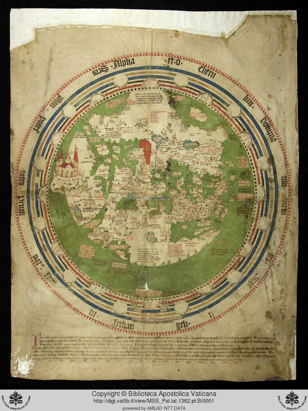
World map (mappamundi) of Andreas Walsperger, Konstanz 1448, Vatican Pal. lat. 1362 pt. B
Weltkarte [catalogue title]
Andreas Walsperger (Benedictine of Salzburg, working at Konstanz)
How we know
compilation Assembled from earlier sources. The author did not observe it directly.
Compilation: south-oriented mappamundi in the Klosterneuburg school tradition mixing Ptolemaic coordinates (per its own legend) with medieval legends; no observation.
Research notes
- Legend states it was made 'ex cosmographia Ptolemaei' in Konstanz 1448 by Andreas Walsperger; related to the Klosterneuburg (Fridericus) map tradition. Same shelfmark family as the Vesconte volume (pt. A) but a separate object.
- Web search (10 hits) located the Heidelberg mirror and the correct Vatican shelfmark.
Why it matters
A dated (1448) mid-15th-century mappamundi that places the Tartar lands and Cathay in a Ptolemaic-influenced scheme just before the printed Ptolemies; useful for showing how the Mongol-era names sit alongside the Gog and Magog legend one generation before Behaim and the Ulm Ptolemy.
Places named
Whole known world, south at top; Asia with Tartar lands, Cathay, India, Gog and Magog enclosure; Europe; Africa
Who copied whom
No copying traced for this map yet. See the family trees.
Keep exploring
The maps drawn just before and just after this one.