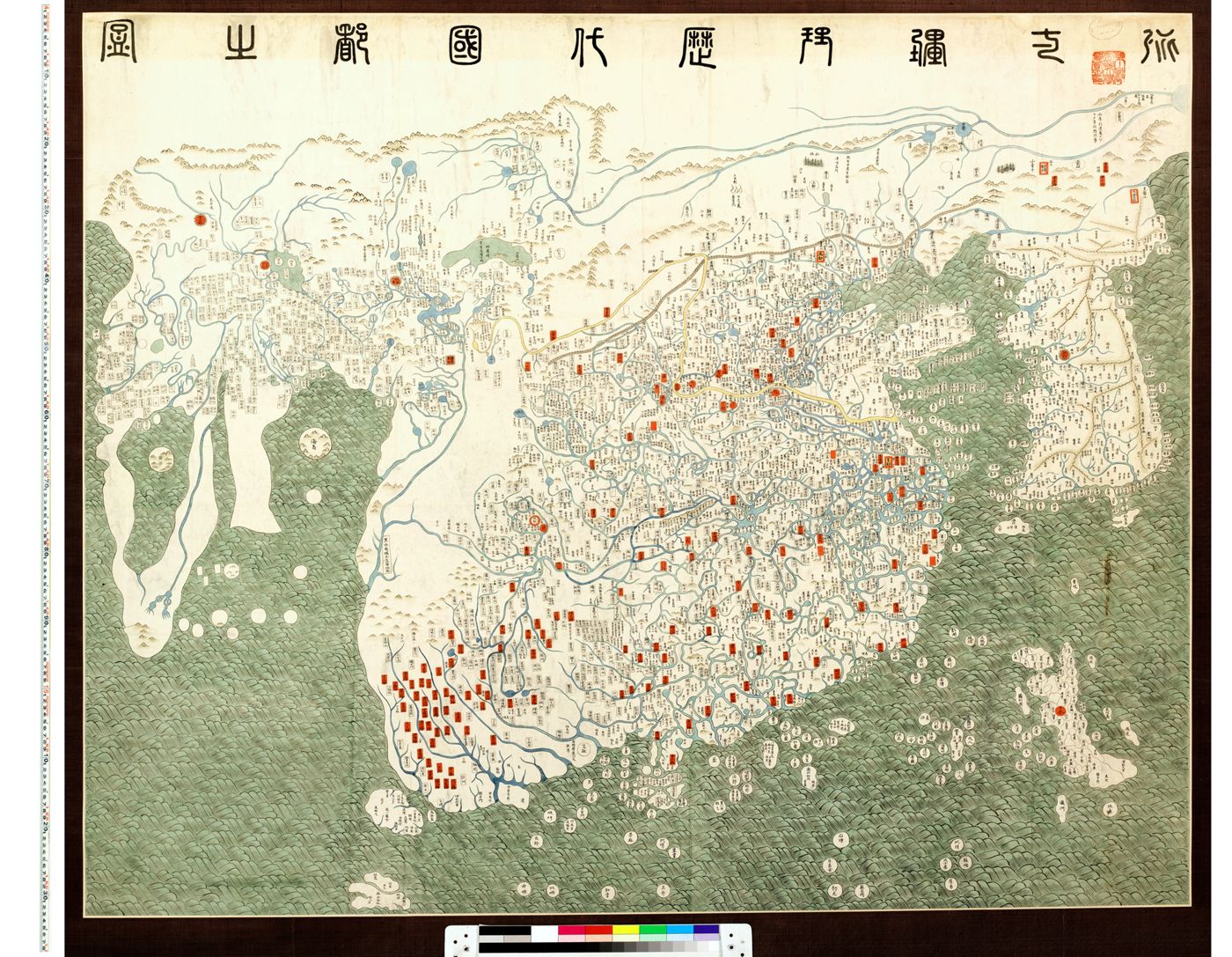
Kangnido (Map of Integrated Lands and Regions of Historical Countries and Capitals), 1402: coloured replica (1910) of the Ryukoku University copy, held by Kyoto University Graduate School of Letters (IIIF)
混一疆理歷代國都之圖
Kwon Kun and Yi Hoe (1402); Ryukoku copy c.1470-1480; Kyoto coloured replica 1910
How we know
compilation Assembled from earlier sources. The author did not observe it directly.
compilation: Korean synthesis (1402) of two Yuan Chinese maps (Li Zemin's Shengjiao guangbei tu and Qingjun's Hunyi jiangli tu) with Korean and Japanese additions; Inner Asia and the West derive from Mongol-era Islamic knowledge
Research notes
- A 1910 hand-coloured copy, not the original; Kyoto notes the postface texts were not copied. The Honkoji copy (Shimabara) and Tenri copy are later variants.
Why it matters
The Kangnido preserves the Mongol-era (Yuan) picture of Inner Asia, Central Asia and the west as known in Korea in 1402, before European Tartary maps existed; the Ryukoku original is not open online, so this faithful 1910 replica is the practical access route.
Places named
Eurasia and Africa; Mongolia, Central Asia (with Timurid cities), Arabia, Africa, Europe in outline; Korea enlarged
Who copied whom
No copying traced for this map yet. See the family trees.
Keep exploring
The maps drawn just before and just after this one.