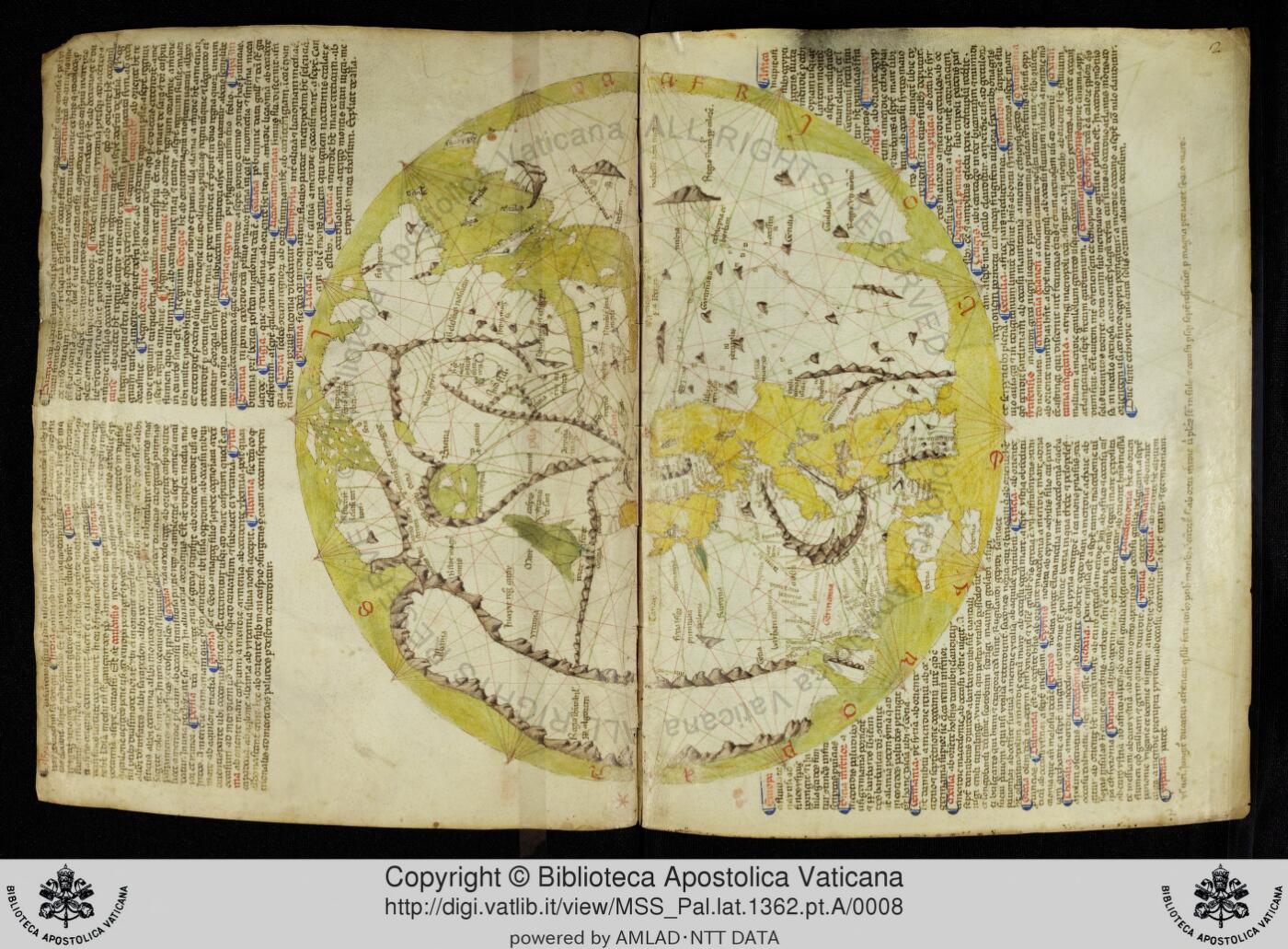
World map (mappamundi) and portolan charts by Pietro Vesconte in a Sanudo manuscript, Vatican Pal. lat. 1362 pt. A
Land- und Seekarten (Portolane) [catalogue title]; mappamundi
Pietro Vesconte (cartographer), maps accompanying Marino Sanudo's Liber secretorum fidelium crucis
How we know
compilation Assembled from earlier sources. The author did not observe it directly.
Compilation: portolan-chart coastlines combined with a circular mappamundi of Asia drawn from written sources (Sanudo's crusading treatise), with early Mongol-era information; no observation of Asia by the maker.
Research notes
- Catalogue (DigiVatLib) attributes the maps to Pietro Vesconte; several Sanudo manuscripts (BL Add MS 27376, Paris, Vatican) carry variants of the same map set, so this copy is one witness among siblings rather than a unique original. Shelfmark on DigiVatLib must be written 'MSS_Pal.lat.1362.pt.A' (other forms return 404).
- The BL copy Add MS 27376 could not be checked (BL digitised manuscripts offline since 2023).
Why it matters
The Vesconte-Sanudo mappamundi is the first Western world map made after the Mongol conquests with a portolan-style frame; it shows the Latin West's early 14th-century picture of Asia at the moment 'Tartari' entered European geography (Sanudo's text discusses Tartar alliances). A companion to the BL Add MS 27376 copy.
Places named
Whole known world with East at top; Asia including Scythia, India, the Caspian, the Tartar lands of Sanudo's text; Mediterranean and Black Sea portolans
Who copied whom
No copying traced for this map yet. See the family trees.
Keep exploring
The maps drawn just before and just after this one.